Neighbourhoods in City of Ottawa | Neighbourhoods in City of Toronto | Local Areas in OH Central |
||
|---|---|---|---|---|

|

|

|
||
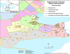
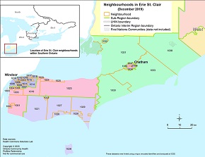
Neighbourhoods in Hamilton Niagara Haldimand Brant | Neighbourhoods in South West | Neighbourhoods in Erie St. Clair | ||
|

|
|
Create Custom Erie St. Clair Neighbourhoods Geography ‐ Tables and Charts
STEP 1 Click-SELECT/deselect on the map or CHECK/uncheck on the checkbox list one or more Neighbourhood areas for which you would like to view data
