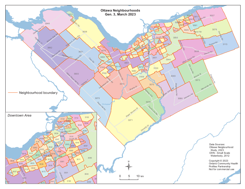
Neighbourhoods in City of Ottawa | Neighbourhoods in City of Toronto | Local Areas in OH Central |
|||
|---|---|---|---|---|---|
|

|

|
|||
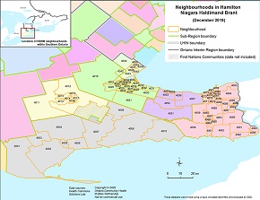
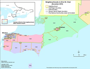
Neighbourhoods in Hamilton Niagara Haldimand Brant | Neighbourhoods in South West | Neighbourhoods in Erie St. Clair | |||
|

|
|
|||
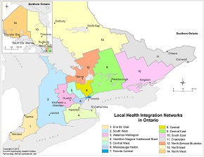
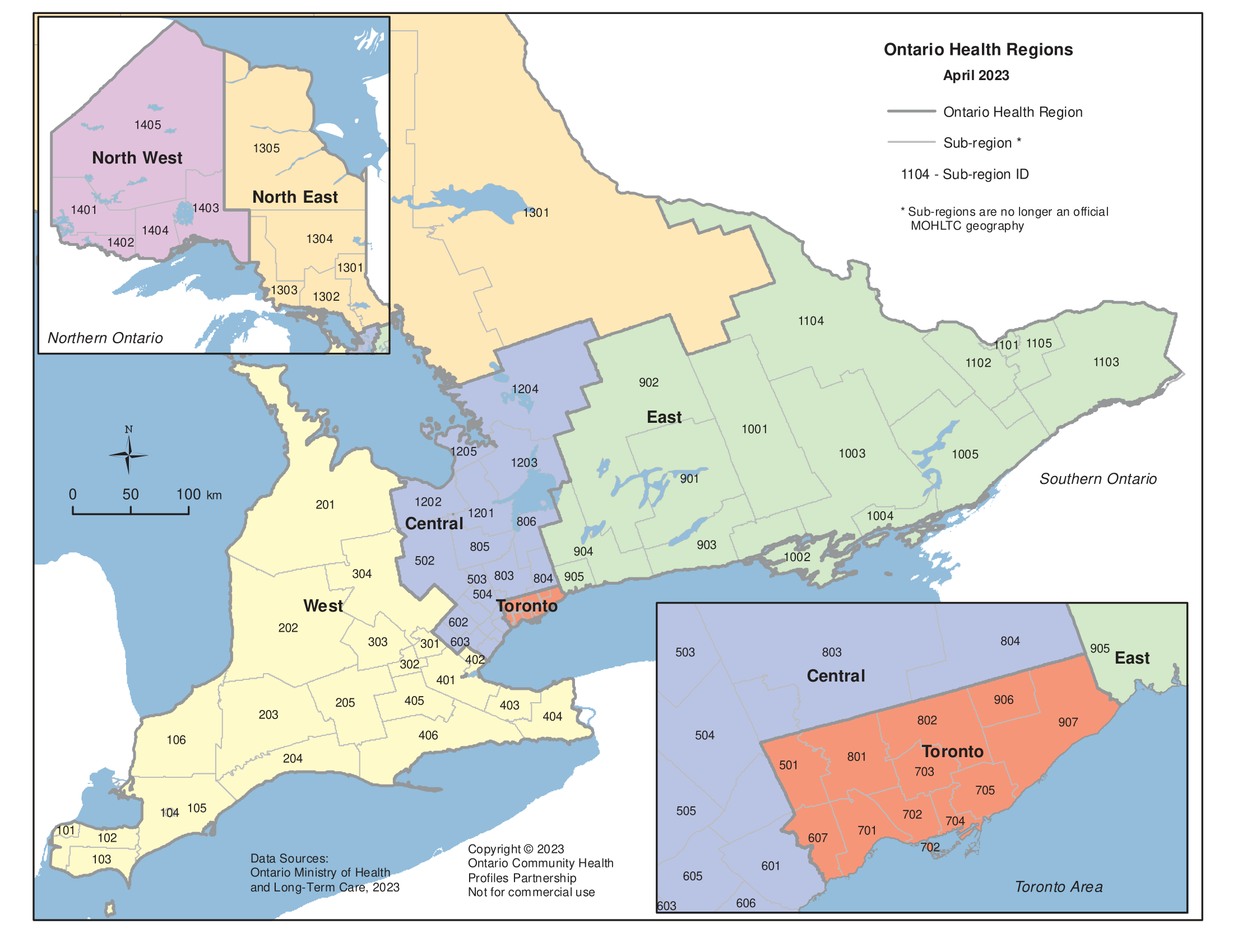
| Ontario Sub-Regions | Ontario Local Health Integration Networks (LHINs) | Ontario Health Regions | |||

|
|
|
Data — Ontario Local Health Integration Networks (LHINs)
Select the Data Topic Category and Year for which you would like to download Data table (EXCEL format), Bar Charts and Maps (PDF format).
Due to limitations, data may not always be provided in table or map form. Bar charts will not be updated. If you require a specific format not available on OCHPP, contact us at healthprofiles@unityhealth.to
The data posted on OCHPP reflects the most up-to-date available from our sources. For older data and maps, see our Archives page.
The data posted on OCHPP reflects the most up-to-date available from our sources. For older data and maps, see our Archives page.
|
|
|
|

|