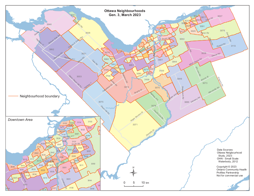
Neighbourhoods in City of Ottawa |
Neighbourhoods in City of Toronto |
Local Areas in OH Central |
||||
|---|---|---|---|---|---|---|
|

|

|
||||
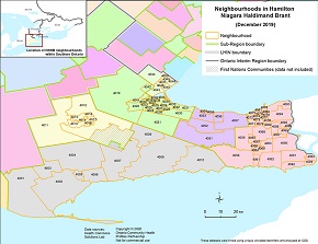
Neighbourhoods in Hamilton Niagara Haldimand Brant |
Neighbourhoods in South West | Neighbourhoods in Erie St. Clair | ||||
|

|

|
||||
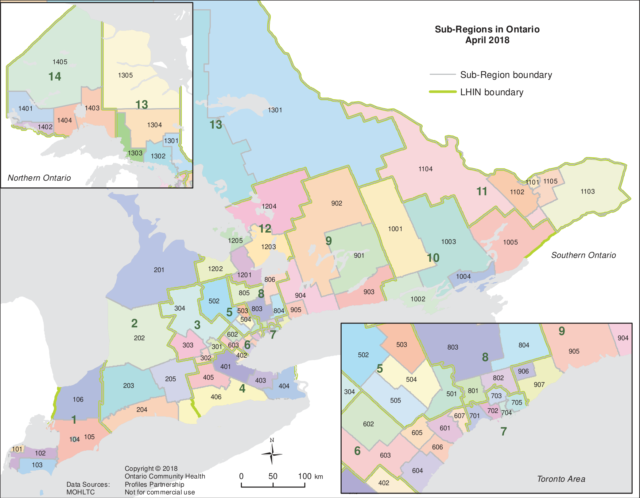
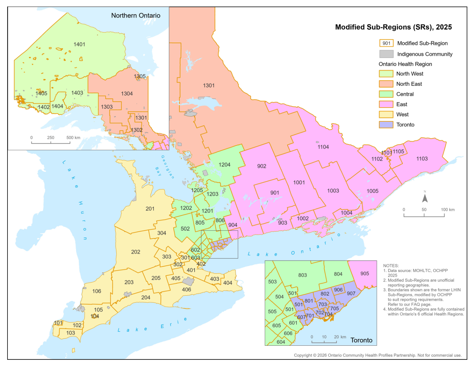
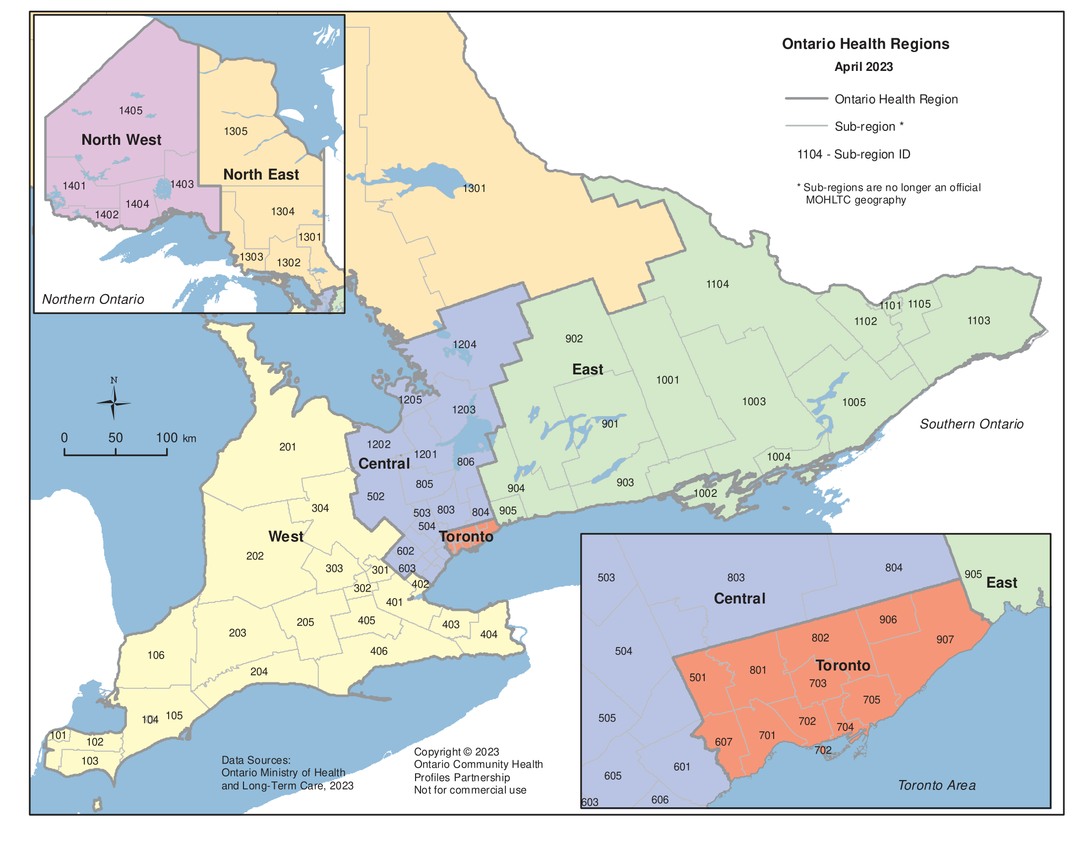
| Ontario Sub-Regions | Modified Sub-Regions | Ontario Health Regions | ||||
|
|
|
||||
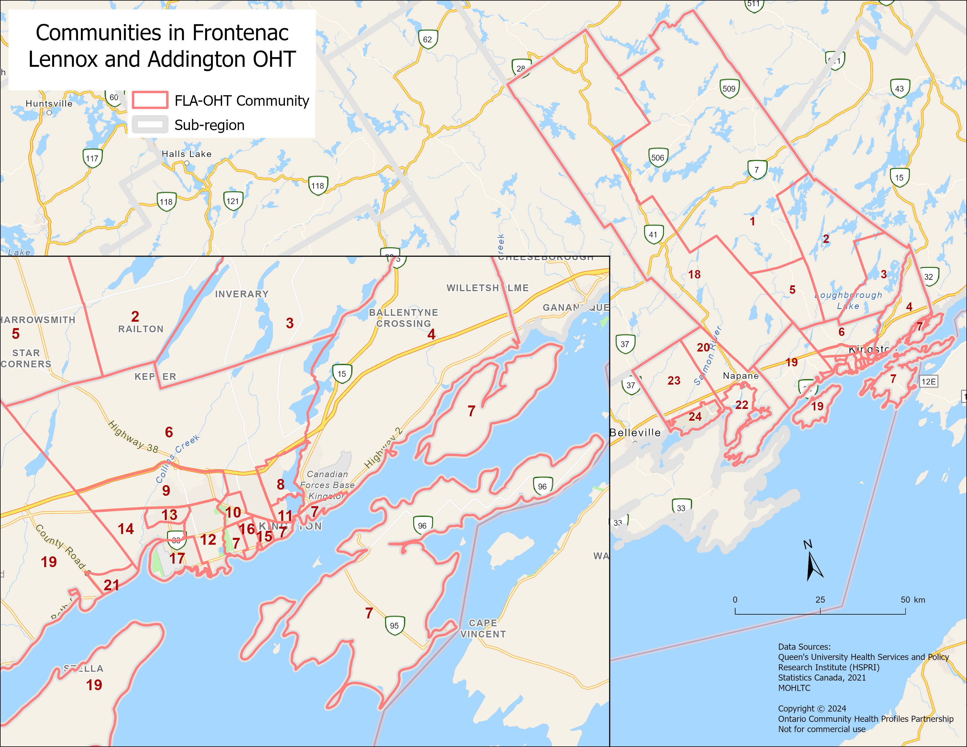
| Frontenac Lennox and Addington – OHT | Durham Health Neighbourhoods | |||||
|

|
Data — Durham Health Neighbourhoods
Select the Data Topic Category and Year for which you would like to download Data table (EXCEL format), Bar Charts and Maps (PDF format).
| Data Topic Category | Durham Health Neighbourhoods | ||
|---|---|---|---|
| Tables | Charts | Maps | |
| (EXCEL) | (BAR CHARTS) | (PDF) | |
| Census-based population denominators | |||
| Census Variables | |||
| Socio-demographic, Census Canada | |||
| Income | |||
| Households and Dwellings | |||
| Population Characteristics | |||
| Registered Persons Database (RPDB)-based population denominators | 2024 | ||
| Adult Health Indicators | Tables | Charts | Maps |
| Primary Care | |||
| Attachment to Primary Care: • Attachment Status: Attached • Attachment Status: Uncertainly Attached |
|||
| Prevention | |||
| Pap smears | 2021/24 | 2021/24 | |
| Mammograms | 2022/24 | 2022/24 | |
| Any Colorectal Cancer Screening | 2022/24 | 2022/24 | |
| Adult Health and Disease | |||
| Diabetes |
|||
| Asthma |
|||
| High Blood Pressure |
|||
| Mental Health and Addiction-related Visits |
Chronic Obstructive Pulmonary Disease |
||
| 2+ Chronic Conditions |
|||
| 4+ Chronic Conditions |
|||
| Emergency Department (ED) Care Visits Indicators | Tables | Charts | Maps |
| Emergency Department Care | |||
| • All Emergency Department (ED) visits • ED visits by High Urgency (HU) • ED visits by Low Urgency (LU) |
2023/25 | ||
| Mental Health and Addiction-related ED visits | 2023/25 | ||
| Hospital Related Conditions Indicators | Tables | Charts | Maps |
| Hospital Admissions | |||
| All Hospital Admissions | |||
| Medical Hospital Admissions | |||
| Mental Health and Addiction-related Hospital Admissions | |||
| Ambulatory Care Sensitive Conditions (ACSC) Hospitalizations | |||
| Tables | Charts | Maps | |
Durham’s Health Neighbourhoods were created by the Durham Region Health Department, with the original boundaries created in 2015 and updated periodically based on population growth. The Neighbourhood boundaries were created by grouping adjacent Statistics Canada Dissemination Areas (DAs) while considering population size, demographic similarities, municipal boundaries, and following physical barriers such as highways, major roads, railway lines, and rivers and creeks.
Due to limitations, data may not always be provided in table or map form. Bar charts will not be updated. If you require a specific format not available on OCHPP, contact us at healthprofiles@unityhealth.to
The data posted on OCHPP reflects the most up-to-date available from our sources. For older data and maps, see our Archives page.

